

Jonathon Hill, a research technician at the Mars Space Flight Facility at Arizona State University, who works with images of the Martian surface taken by rovers and satellites, as well as data from Earth-orbiting NASA instruments has provided some explanation for unusual structures in China’s desert. These are newfound Google Maps images which reveal an array of mysterious structures and patterns etched into the surface of China’s Gobi Desert.
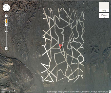
This strange grid of randomly zigzagging white lines, which are probably painted onto the land surface, is most likely used to calibrate China’s spy satellites, Hill said. Satellite cameras focus on the grid, which measures approximately 0.65 miles wide by 1.15 miles long, and use it to orient themselves in space
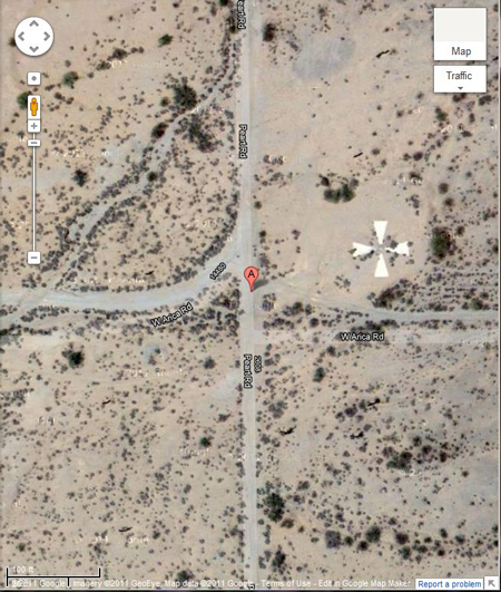
A calibration target for the Corona spy satellites, built back in the 1960s, down in Casa Grande, AZ, at coordinates 32° 48′ 24.74
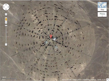
This Stonehenge-like arrangement of objects radiating outward, with fighter jets at its center, is almost certainly a calibration/test target for orbital radar instruments, Hill said. The bumps in the terrain around the planes scatter radar away from the area, partially masking the planes. By testing radar return from this structure using radar instruments flying overhead, Chinese radar experts can learn how best to hide China’s military operations from other countries’ spy satellites.
According to Hill, this is most likely some sort of Yagi antennae array. The grid may in fact be a series of roads they’ve constructed to build and maintain the array, which is constructed of towers and wires, which are too small and thin to be seen without a higher resolution image. This is probably comparable to the SHARE antenna in Antarctica, Hill said. Antenna arrays like this can be used for a huge number of things — such as weather tracking, space weather tracking and high-altitude atmospheric research — all of which are interesting to militaries.

This is believed to be a weapons testing range
If you liked this article, please give it a quick review on ycombinator or StumbleUpon. Thanks

Brian Wang is a Futurist Thought Leader and a popular Science blogger with 1 million readers per month. His blog Nextbigfuture.com is ranked #1 Science News Blog. It covers many disruptive technology and trends including Space, Robotics, Artificial Intelligence, Medicine, Anti-aging Biotechnology, and Nanotechnology.
Known for identifying cutting edge technologies, he is currently a Co-Founder of a startup and fundraiser for high potential early-stage companies. He is the Head of Research for Allocations for deep technology investments and an Angel Investor at Space Angels.
A frequent speaker at corporations, he has been a TEDx speaker, a Singularity University speaker and guest at numerous interviews for radio and podcasts. He is open to public speaking and advising engagements.